Best Hikes in the Redwoods
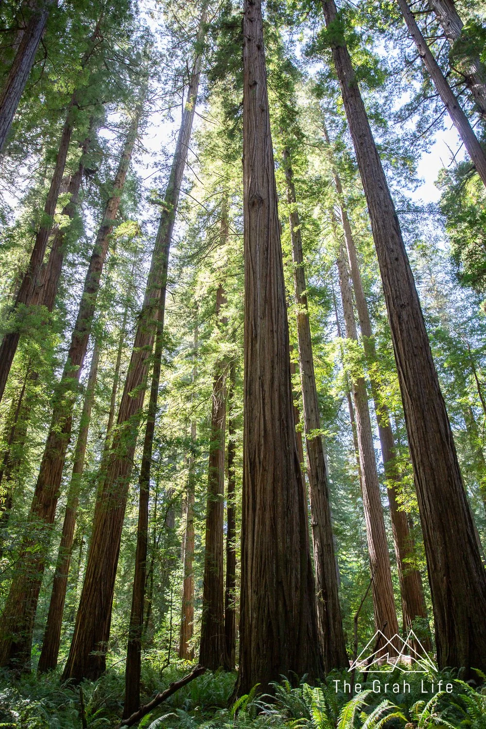
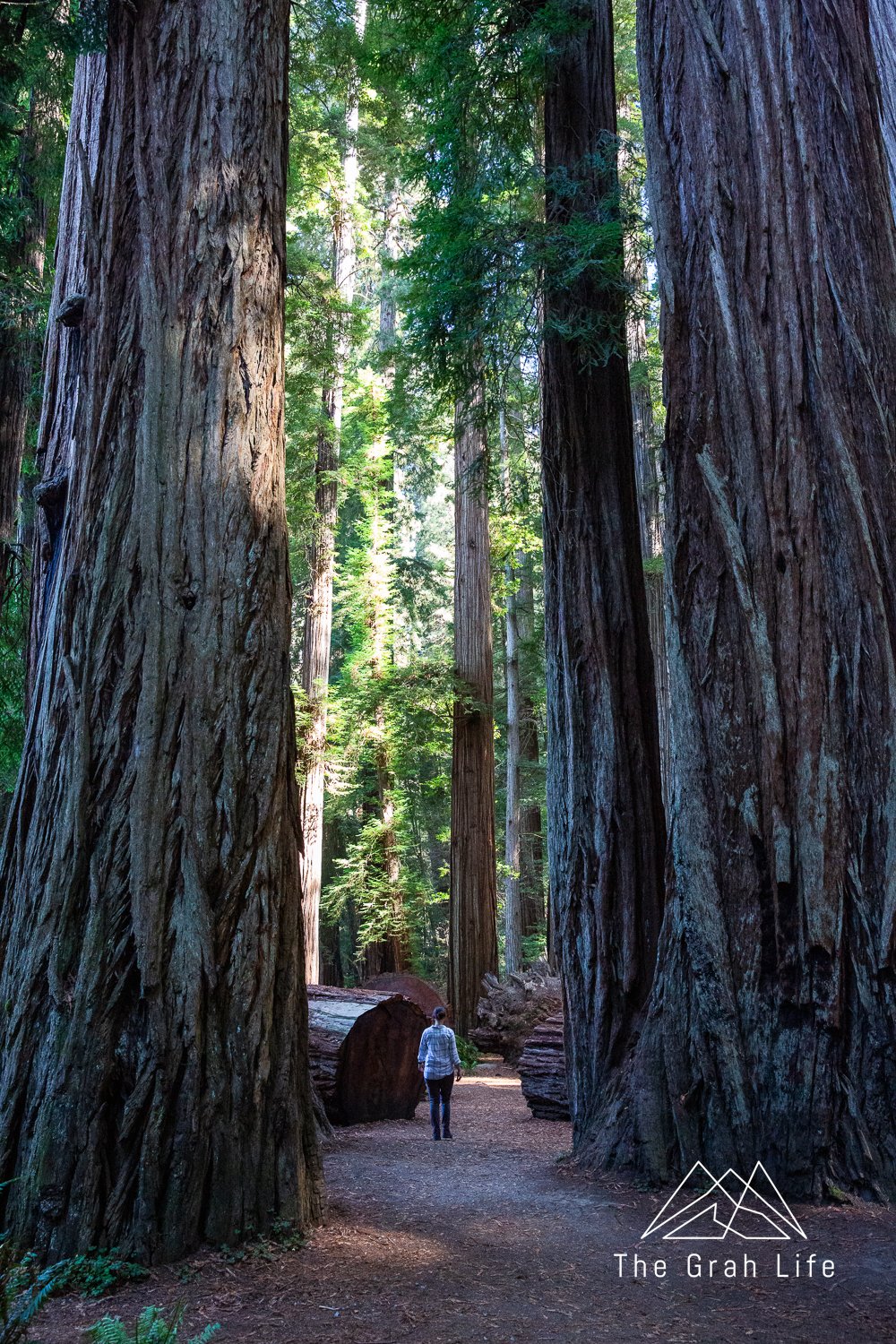
Did you know that redwood trees can get to be taller than 30-floor skyscrapers!? That’s more than 320 feet high, with trunks that can grow more than 27 feet wide. Walking through these 2,000-year-old giants is awe-inspiring. Hike early to beat the crowds and get those beautiful sun rays shining through the trees.

Source: Save the Redwoods
Please note that none of the trails within the park system are dog friendly. Check this list for pet-friendly spots nearby.
Know what area you want to hike at? Click below to skip to an area:
Jedediah Smith State Park
The northernmost part of the Redwoods, Jedediah Smith State Park is an easy day trip from Oregon. It’s densely forested, containing seven percent of all the old-growth redwoods left in the world.
Simpson-Reed Trail
Trail description: Alltrails
Distance: 0.9 miles
Elevation gain: 62 feet
Season: May to October
This trail is known for its ferns. The trees, as expected, are huge, but in some places, the ferns were nearly as tall as Meghann! The trail is shorter side, but it’s a beautiful loop, with the option to make it a bit longer by adding on the Peterson Memorial Trail. It’s less popular, but worth the stop.

Hiouchi Trail
Trail description: Alltrails
Distance: 4.7 miles
Elevation gain: 347 feet
Season: March to October
The highlight of this trail is the seasonal footbridge that spans the Smith River between the Jedediah Smith Campground and Stout Grove in the summer months. The trail runs from Lohse Grove to Stout Grove. Although there are a few spots with river access, it doesn’t have especially large trees.
Stout Memorial Grove
Trail description: Alltrails
Distance: 0.6 miles
Elevation gain: 32 feet
Season: Year round
Located off Howland Hill Road, Stout Memorial Grove is among the more popular hikes in the Jedediah Smith State Park. It’s worth the stop because you’ll get to walk by the most impressive downed redwood trees. The trail is only 0.6 miles, but you’ll start your hike on a steep hill.

Grove of Titans
Trail description: Alltrails
Distance: 1.7 miles
Elevation gain: 137 feet
Season: April to October
“The Titans” are a group of redwood trees named for their remarkable size and shape. They’re incredibly large trees with complex features you won’t see elsewhere. Located on Howland Hill Road, the grove is especially lush and isolated feeling despite its popularity. We consider this trail a must do!
The Boy Scout Tree Trail
Trail description: Alltrails
Distance: 5.2 miles
Elevation gain: 951 feet
Season: Year round
This is another great hike off Howland Hill Road — people love this one because it’s one of the few trails you can walk without hearing the noise of traffic throughout the Redwoods park system. The largest trees are near the start of the hike, so it’s worth wandering even if you don’t hike the full 5.5 miles out and back. The hike ends at Fern Falls, but don’t get too excited about the prospect of a waterfall. Fern Falls is just a small trickle of water.
Parking here is tight. If you don’t get one of the six spots at the trailhead, you may be lucky enough to find a spot on the side of the road. If not, consider hiking Nickerson Ranch Trail just a ways up the road. It’s not as scenic, but it gets far less traffic.
Del Norte Redwoods State Park
Located just south of Crescent City, this section of the Redwoods National Park has 50% of the old growth coast redwoods in the park and eight beautiful miles of coastline.
Damnation Creek Trail
Trail description: Alltrails
Distance: 3.9 miles
Elevation gain: 1,190 feet
Season: Year round
Finding this trailhead is tricky. It’s an unmarked pullout on the southbound side of Highway 101 at mile marker 16. You can find it on Google maps here. Unfortunately, there are no turn lanes coming from the northbound lanes.
You’ll see the largest redwoods at the start of the trail, and they’ll progressively get smaller the closer you get to the ocean. Look for huckleberries and rhododendrons blooming in spring!
At the end of the trail, you’ll find a bluff top with ocean views. The descent to the beach is unstable, and, depending on the tide, may not be accessible. If the tide is low, be cautious wandering past the Midway Point to the north and the unnamed southern point about 100 yards to the south, where it’s possible to get trapped by the incoming tide.
Enderts Beach Via California Coastal Trail
Trail description: Alltrails
Distance: 1.3 miles
Elevation gain: 173 feet
Season: Year round
Check the tide charts before hiking to Enderts Beach — you’ll want to go tide pooling here! Beware that getting onto the beach is a bit of a scramble. If the tide is low enough, wander to the end of the beach to find a rock with an arch in it. Be aware of the incoming tide here though – it’s possible to get trapped past this point.
Prairie Creek Redwoods State Park
Near the town of Orick, Prairie Creek Redwoods State Park claims 14,000 acres. It’s a coastal sanctuary, so you can expect lush vegetation and mossy trails. If you’re lucky, you’ll see Roosevelt elk grazing here too.
Tall Trees Trail
Trail description: Alltrails
Distance: 3.61 miles
Elevation gain: 780 feet
Season: March to October
Home to Hyperion — the world’s tallest tree! Although it’s a strenuous hike, with a steep climb down to the grove and back up to the trailhead, you’ll need a reservation to reach it. Expect to spend at least four hours hiking and driving to and from this trail. A great nearby alternative is the Lady Bird Johnson Grove Trail.
Fern Canyon
Trail description: Alltrails
Distance: 1.1 miles
Elevation gain: 127 feet
Season: Year round
Fern Canyon is by far the most popular trail in Prairie Creek, but for good reason. Hike this easy loop to walk through a beautiful 50- to 80-foot-deep canyon filled with ferns.
Parking at the Fern Canyon Trailhead is by reservation between mid-May and mid-Septebmer. Hike the Miners Ridge and James Irvine Loop, described below, to view Fern Canyon without a reservation.
Miner’s Ridge and James Irvine Loop
Trail description: Alltrails
Distance: 11.5 miles
Elevation gain: 1,473 feet
Season: Year round
One of the more popular hikes, this hike is well-loved because of its old-growth forests and variety of scenery. Hike here and you’ll see redwoods, an undeveloped beach that elk frequent, the famous Fern Canyon, and a lush creek valley.
Note that when you’re walking North along on the beach, the path to the Fern Canyon parking lot and James Irvine Trail cannot be seen from the beach. To find the lot, look for people entering the beach and keep track of your mileage once you’re on the beach. It’s 1.2 miles north from where you’ll enter the beach at Gold Bluffs Beach Campground.
Although this trail is accessible year round, in winter or after heavy rainfalls, do not expect to be able to cross from the beach to the Fern Canyon without wading. In summer, you’ll find small planks to walk across.
West Ridge Trail to Karl Knapp Trail Loop
Trail description: Alltrails
Distance: 5.5 miles
Elevation gain: 820 feet
Season: Year round
Known for having the best scenery in Prairie Creek, you’ll find the most impressive redwoods in the lowlands on the Karl Knapp Trail, but the West Ridge Trail following the ridgetop is a worthwhile addition.
Bonus — hike here before the Drury Parkway opens to experience it without the traffic noise.
Note that in winter, a seasonal footbridge on the Karl Knapp Trail is removed and you’ll need to wade through a creek that’s usually three inches deep and ten feet wide to complete the loop.
Brown Creek Trail
Trail description: Alltrails
Distance: 2.4 miles
Elevation gain: 423 feet
Season: April to September
Brown Creek is less popular but still boasts of dense old-growth forests and a small creek. Although it’s beautiful as an out-and-back, you can add a mile to your hike and make it a loop by following the Rhododendron Trail and the South Fork Trail.
Big Tree Loop
Trail description: Alltrails
Distance: 2.9 miles
Elevation gain: 213 feet
Season: Year round
Hike here to see huge redwoods! The Big Tree has a 21-foot diameter and is one of the largest redwoods in Prairie Creek. For a shorter walk, do the Big Tree via Circle Trail. Bonus — these trails are wheelchair friendly!
Moorman-Pond Trail
Trail description: Alltrails
Distance: 0.7 miles
Elevation gain: 167 feet
Season: Year round
Despite the name, there is no pond here. Instead, you can expect an impressive redwood-filled canyon. It’s short but worth the stop along the Drury Parkway.
Coastal Trail, Flint Ridge Section
Trail description: Alltrails
Distance: 8.4 miles
Elevation gain: 1,958 feet
Season: Year round
You’ll start your hike among red alder and spruce since redwoods don’t typically grow near sea level. However, just two miles in, you’ll find the best redwoods on the trail. If you hike past this, you’ll arrive at Marshall Pond. Look for huckleberries on your way there.
Humboldt Redwoods State Park
The Humboldt Redwoods is almost twice the size of San Francisco — spanning 53,000 acres, including about 17,000 of which are old-growth redwood forests. Hike here for beautiful views of the Eel River, and of course, massive redwoods.
The Big Tree Loop
Trail description: Alltrails
Distance: 0.3 miles
Elevation gain: 22 feet
Season: Year round
Most visitors stop here to see the Giant Tree and leave, but they’re missing out on an easy ten-minute walk through an incredible grove with huge trees. Bonus — This trail is wheelchair accessible.
Founders’ Grove
Trail description: Alltrails
Distance: 0.5 miles
Elevation gain: 32 feet
Season: Year round
The Founders’ Grove is one of the more popular trails in the Humboldt Redwoods State Park. The grove feels expansive — there are huge redwoods as far as you can see in every direction. If you’re looking for an easy, yet stunning hike, this is it.
Rockefeller Loop
Trail description: Alltrails
Distance: 0.6 miles
Elevation gain: 36 feet
Season: Year round
Although this forest is smaller and darker than the nearby and more popular Founders’ Grove, it’s quieter, too. Keep an eye out for the sign saying “Rockefeller Forest / Lower Bull Creek Flats” off Mattole Road to find the road to the trailhead. It’s easy to miss in the shade of the trees.
Children’s Forest Trail
Trail description: Alltrails
Distance: 1.7 miles
Elevation gain: 187 feet
Season: June to September
Just a little way away from the popular Avenue of Giants, this grove sees very few visitors. Having burned in the Canoe Creek Fire in 2006, you’ll find little evidence of the fire aside from some blackened trunks and lack of understory vegetation, which only accentuates the size of these redwoods.
Grieg-French-Bell Grove
Trail description: Alltrails
Distance: 1.4 miles
Elevation gain: 22 feet
Season: Year round
With redwood sorrel covering the forest floor, hiking here feels like walking through a fairy wonderland. You may even recognize this trail from movies and commercials! The Drury-Chaney Loop is a similar, although a less impressive option.
High Rock Trail
Trail description: Redwood Hikes
Distance: 3 miles
Elevation gain: 280 feet
Season: Year round
This is such a beautiful trail, but it sees so few visitors because the trailhead is hard to find. If you can reach the trailhead (here), you’ll find an unmarked trail. Hike across a bridge to start your hike. Eventually, you’ll reach a small ridge with an unmarked trail that climbs to the left. Hike up it to reach the top of High Rock with a great view of the Eel River. Beware of poison oak here as well.
Leave no trace
Following the Leave No Trace Principles is especially important in our well-trafficked national parks. Please stay on designated trails to prevent hurting the redwood tree’s root structure and do not walk on fallen trees — they are part of the ecosystem!
What to pack
Check out our list of favorite hiking gear here, but prioritize packing waterproof shoes with great traction, and layers. The weather changes quickly here, so having a raincoat and mid-layer are a must.


Search the blog for more adventures! Try searching for topics such as “hiking”, “waterfalls”, or “Arizona”.